The Valley interactive map
Use the original Valley map to find villages, wagon stops, mines, deposits, animals and quest objectives. Start near Gostovia and use the Mapped crossings layer to see where the game map shows a route across the water.
Map markers
Choose a layer, then use its filter to find a place, resource or objective. Quest names use the English game tables. Objective directions are editorial descriptions.
Filter stock by quantity
The quantity applies to one merchant. Check access and the stock remaining at the shop.

1
2
3
4
5
6
7
8
9
10
11
12
13
14
15
16
17
18
19
20
21
22
23
24
25
26
27
28
29
30
31
32
33
34
35
36
37
38
39
40
41
42
43
44
45
46
47
48
49
50
51
52
53
54
55
56
57
58
59
60
61
62
63
64
65
66
67
68
69
70
71
72
73
74
75
76
77
78
79
80
81
82
83
84
85
86
87
88
89
90
91
92
93
94
95
96
97
98
99
100
101
102
103
104
105
106
107
108
109
110
111
112
113
114
115
116
117
118
119
120
121
122
123
124
125
126
127
128
129
130
131
132
133
134
135
136
137
138
139
140
141
142
143
144
145
146
147
148
149
150
151
152
Villages and places (11)
Village merchants (11)
The item filter uses configured vendor stocks. Quantities and access depend on restock, season, year and quests. The village marker is a starting point.
- Baranica
- Borowo
- Branica
- Sambor’s home
 Sambor · Figurines
Item stock
Stock unlocks through a quest
- Denica
- Gostovia
- Hornica
- Jezerica
- Lesnica
- Rolnica
- Tutki










Encounter merchants (13)
The game selects possible sites each season and activates the selected encounters when a player comes near.
- Vendor Beetroot and seeds Straight-line distance, about 360 m north of Jezerica. Starting stock for the item
- Vendor Beetroot and seeds Straight-line distance, about 210 m southeast of Baranica. Starting stock for the item
- Vendor Beetroot and seeds Straight-line distance, about 460 m east of Jezerica. Starting stock for the item
- Vendor Beetroot and seeds Straight-line distance, about 330 m south of Gostovia. Starting stock for the item
- Vendor Potions Straight-line distance, about 130 m east of Tutki. Starting stock for the item
- Vendor Potions Straight-line distance, about 280 m south of Sambor’s home. Starting stock for the item
- Vendor Potions Straight-line distance, about 230 m north of Denica. Starting stock for the item
- Vendor Potions Straight-line distance, about 300 m south of Lesnica. Starting stock for the item
- Vendor Buys items through dialogue Straight-line distance, about 270 m south of Branica.
- Vendor Buys items through dialogue Straight-line distance, about 330 m west of Gostovia.
- Vendor Buys items through dialogue Straight-line distance, about 250 m north of Lesnica.
- Vendor Buys items through dialogue Straight-line distance, about 400 m south of Baranica.
- Vendor Buys items through dialogue Straight-line distance, about 240 m southwest of Denica.
Quest characters (3)
Each marker shows the place associated with these characters in the quest tables. Check your journal to find them at your current quest stage.
Quest objectives (11)
- Cobbled With Coins Stage 1 · Go to Denica Straight-line distance, less than 10 m from Denica. Compare wagon fares and distances
- The Call of the Mountains
Stage 3 · Find the Bear’s Mouth
Straight-line distance, about 470 m east of Hornica.
- Stage 5 marker · Visit the Sombrabîme caveAbout 180 m · south
- Stage 5 marker · Find the cellar in Val-StérileAbout 750 m · west
- Stage 5 marker · Find the Bruineroche cavernAbout 1,180 m · west
- The Call of the Mountains
Stage 3 · Find the Ruissepierres
Straight-line distance, about 410 m south of Gostovia.
- Stage 5 marker · Find the cellar in Val-StérileAbout 110 m · southwest
- Stage 5 marker · Find the Bruineroche cavernAbout 690 m · southwest
- Stage 5 marker · Visit the Sombrabîme caveAbout 790 m · southeast
- The Call of the Mountains
Stage 3 · Visit the Fenderoche spring
Straight-line distance, about 240 m west of Hornica.
- Stage 5 marker · Find the cellar in Val-StérileAbout 380 m · north
- Stage 5 marker · Find the Bruineroche cavernAbout 500 m · west
- Stage 5 marker · Visit the Sombrabîme caveAbout 660 m · east
- The Call of the Mountains
Stage 5 · Find the cellar in Val-Stérile
Straight-line distance, about 500 m northwest of Hornica.
- Stage 7 marker · Find the Knight’s RestAbout 220 m · southwest
- Stage 7 marker · Find the King’s LookoutAbout 420 m · southwest
- Stage 7 marker · Visit the top of the southern rampartAbout 540 m · south
- The Call of the Mountains
Stage 5 · Find the Bruineroche cavern
Straight-line distance, about 260 m northeast of Jezerica.
- Stage 7 marker · Find the King’s LookoutAbout 180 m · northeast
- Stage 7 marker · Find the Knight’s RestAbout 360 m · northeast
- Stage 7 marker · Visit the top of the southern rampartAbout 680 m · east
- The Call of the Mountains
Stage 5 · Visit the Sombrabîme cave
Straight-line distance, about 420 m east of Hornica.
- Stage 7 marker · Visit the top of the southern rampartAbout 510 m · west
- Stage 7 marker · Find the Knight’s RestAbout 960 m · west
- Stage 7 marker · Find the King’s LookoutAbout 1,090 m · west
- The Call of the Mountains
Stage 7 · Find the Knight’s Rest
Straight-line distance, about 570 m northwest of Hornica.
- Stage 9 marker · Find the mysterious treeAbout 190 m · east
- The Call of the Mountains
Stage 7 · Find the King’s Lookout
Straight-line distance, about 430 m northeast of Jezerica.
- Stage 9 marker · Find the mysterious treeAbout 370 m · east
- The Call of the Mountains
Stage 7 · Visit the top of the southern rampart
Straight-line distance, about 120 m southwest of Hornica.
- Stage 9 marker · Find the mysterious treeAbout 460 m · northwest
- The Call of the Mountains Stage 9 · Find the mysterious tree Straight-line distance, about 420 m northwest of Hornica. Compare wagon fares and distances
Mines and caves (6)
- Mine site northeast of Branica Mine construction site Straight-line distance, about 130 m northeast of Branica.
- Mine site south of Lesnica Mine construction site Straight-line distance, about 280 m south of Lesnica.
- Mine site northeast of Jezerica Mine construction site Straight-line distance, about 250 m northeast of Jezerica.
- Mine site northwest of Hornica Mine construction site Straight-line distance, about 500 m northwest of Hornica.
- Mine site east of Hornica Mine construction site Straight-line distance, about 450 m east of Hornica.
- Cave entrance east of Hornica Entrance model mapped in the level Straight-line distance, about 490 m east of Hornica.
Deposits (152)
Nearby deposits share a marker. The marker list shows how many deposits were mapped in each area.
- Clay deposit 2 mapped deposits
- Clay deposit 6 mapped deposits
- Clay deposit 1 mapped deposit
- Clay deposit 3 mapped deposits
- Clay deposit 1 mapped deposit
- Clay deposit 2 mapped deposits
- Clay deposit 1 mapped deposit
- Clay deposit 3 mapped deposits
- Clay deposit 13 mapped deposits
- Clay deposit 6 mapped deposits
- Clay deposit 5 mapped deposits
- Clay deposit 6 mapped deposits
- Clay deposit 9 mapped deposits
- Clay deposit 1 mapped deposit
- Clay deposit 1 mapped deposit
- Clay deposit 2 mapped deposits
- Clay deposit 4 mapped deposits
- Clay deposit 6 mapped deposits
- Clay deposit 5 mapped deposits
- Clay deposit 1 mapped deposit
- Clay deposit 1 mapped deposit
- Clay deposit 4 mapped deposits
- Clay deposit 3 mapped deposits
- Clay deposit 2 mapped deposits
- Clay deposit 3 mapped deposits
- Clay deposit 6 mapped deposits
- Clay deposit 1 mapped deposit
- Clay deposit 1 mapped deposit
- Clay deposit 4 mapped deposits
- Clay deposit 1 mapped deposit
- Clay deposit 4 mapped deposits
- Clay deposit 9 mapped deposits
- Clay deposit 7 mapped deposits
- Clay deposit 3 mapped deposits
- Clay deposit 4 mapped deposits
- Clay deposit 2 mapped deposits
- Clay deposit 3 mapped deposits
- Copper deposit 1 mapped deposit
- Copper deposit 14 mapped deposits
- Copper deposit 1 mapped deposit
- Copper deposit 4 mapped deposits
- Copper deposit 1 mapped deposit
- Copper deposit 4 mapped deposits
- Copper deposit 9 mapped deposits
- Copper deposit 1 mapped deposit
- Copper deposit 2 mapped deposits
- Copper deposit 10 mapped deposits
- Copper deposit 2 mapped deposits
- Copper deposit 3 mapped deposits
- Copper deposit 10 mapped deposits
- Copper deposit 3 mapped deposits
- Copper deposit 9 mapped deposits
- Copper deposit 1 mapped deposit
- Copper deposit 4 mapped deposits
- Copper deposit 5 mapped deposits
- Copper deposit 10 mapped deposits
- Copper deposit 3 mapped deposits
- Copper deposit 1 mapped deposit
- Copper deposit 6 mapped deposits
- Copper deposit 3 mapped deposits
- Copper deposit 6 mapped deposits
- Copper deposit 2 mapped deposits
- Copper deposit 6 mapped deposits
- Copper deposit 1 mapped deposit
- Tin deposit 1 mapped deposit
- Tin deposit 1 mapped deposit
- Tin deposit 14 mapped deposits
- Tin deposit 3 mapped deposits
- Tin deposit 1 mapped deposit
- Tin deposit 5 mapped deposits
- Tin deposit 10 mapped deposits
- Tin deposit 1 mapped deposit
- Tin deposit 1 mapped deposit
- Tin deposit 2 mapped deposits
- Tin deposit 9 mapped deposits
- Tin deposit 2 mapped deposits
- Tin deposit 1 mapped deposit
- Tin deposit 8 mapped deposits
- Tin deposit 2 mapped deposits
- Tin deposit 1 mapped deposit
- Tin deposit 4 mapped deposits
- Tin deposit 8 mapped deposits
- Tin deposit 1 mapped deposit
- Tin deposit 3 mapped deposits
- Tin deposit 12 mapped deposits
- Tin deposit 4 mapped deposits
- Tin deposit 1 mapped deposit
- Tin deposit 3 mapped deposits
- Tin deposit 6 mapped deposits
- Tin deposit 4 mapped deposits
- Tin deposit 4 mapped deposits
- Tin deposit 8 mapped deposits
- Tin deposit 2 mapped deposits
- Iron deposit 7 mapped deposits
- Iron deposit 1 mapped deposit
- Iron deposit 2 mapped deposits
- Iron deposit 9 mapped deposits
- Iron deposit 6 mapped deposits
- Iron deposit 1 mapped deposit
- Iron deposit 3 mapped deposits
- Iron deposit 2 mapped deposits
- Iron deposit 13 mapped deposits
- Iron deposit 1 mapped deposit
- Iron deposit 2 mapped deposits
- Iron deposit 9 mapped deposits
- Iron deposit 10 mapped deposits
- Iron deposit 4 mapped deposits
- Iron deposit 1 mapped deposit
- Iron deposit 8 mapped deposits
- Iron deposit 1 mapped deposit
- Iron deposit 3 mapped deposits
- Iron deposit 6 mapped deposits
- Iron deposit 14 mapped deposits
- Iron deposit 3 mapped deposits
- Iron deposit 2 mapped deposits
- Iron deposit 15 mapped deposits
- Iron deposit 9 mapped deposits
- Iron deposit 4 mapped deposits
- Salt deposit 2 mapped deposits
- Salt deposit 2 mapped deposits
- Salt deposit 7 mapped deposits
- Salt deposit 2 mapped deposits
- Salt deposit 5 mapped deposits
- Salt deposit 1 mapped deposit
- Salt deposit 1 mapped deposit
- Salt deposit 3 mapped deposits
- Salt deposit 1 mapped deposit
- Salt deposit 2 mapped deposits
- Salt deposit 1 mapped deposit
- Salt deposit 8 mapped deposits
- Salt deposit 1 mapped deposit
- Salt deposit 5 mapped deposits
- Salt deposit 3 mapped deposits
- Salt deposit 6 mapped deposits
- Salt deposit 1 mapped deposit
- Salt deposit 2 mapped deposits
- Salt deposit 2 mapped deposits
- Salt deposit 6 mapped deposits
- Salt deposit 1 mapped deposit
- Salt deposit 5 mapped deposits
- Salt deposit 2 mapped deposits
- Salt deposit 1 mapped deposit
- Salt deposit 8 mapped deposits
- Salt deposit 2 mapped deposits
- Salt deposit 1 mapped deposit
- Salt deposit 2 mapped deposits
- Salt deposit 1 mapped deposit
- Salt deposit 8 mapped deposits
- Salt deposit 2 mapped deposits
- Salt deposit 5 mapped deposits
- Salt deposit 1 mapped deposit
- Salt deposit 2 mapped deposits
Mapped crossings (5)
Lines on the game map connect the banks at these approximate locations. Check the structure and whether you can cross in game.
- West crossing at the confluence Straight-line distance, about 290 m southeast of Rolnica.
- East crossing at the confluence Straight-line distance, about 300 m south of Tutki.
- Crossing before the river bend Straight-line distance, about 300 m west of Borowo.
- Crossing between Borowo and Gostovia Straight-line distance, about 150 m southwest of Borowo.
- Crossing west of the large eastern lake Straight-line distance, about 250 m southeast of Borowo.
Foraging (1713)
One surveyed specimen marks each area. Check the item page for its gathering seasons.
Trees (203)
One surveyed tree marks each area. Its count shows how many trees of the selected species were mapped there.
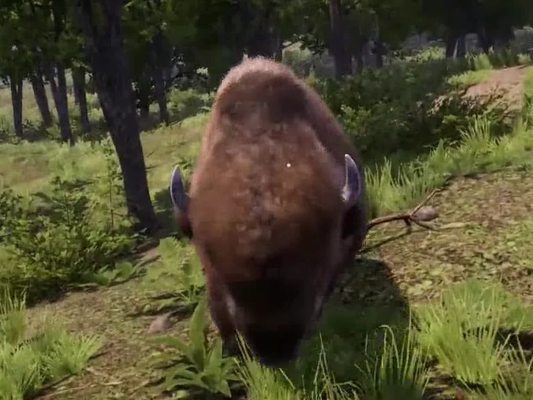
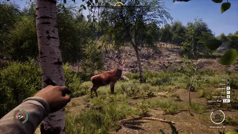
Wildlife (537)
Each marker shows a spawn point from the level data. Animals can move around it.
Fishing (53)
Each marker shows a fish school. Its range comes from the school’s size settings. The icon shows the catch in your inventory.
Legendary animals (75)
These points show possible spawns for the selected variant. For fish, the icon shows the trophy in your inventory. Check whether the variant has appeared in your game.
Map Pack archive · 2021 (101)
Approximate locations from the 2021 Map Pack, aligned to the Valley background. Their presence and contents in the current version remain unverified.
- Bandit marker 1 Straight-line distance, about 140 m east of Tutki.
- Bandit marker 2 Straight-line distance, about 90 m northwest of Baranica.
- Bandit marker 3 Straight-line distance, about 220 m east of Baranica.
- Bandit marker 4 Straight-line distance, about 120 m south of Rolnica.
- Bandit marker 5 Straight-line distance, about 370 m south of Tutki.
- Bandit marker 6 Straight-line distance, about 270 m southwest of Branica.
- Bandit marker 7 Straight-line distance, about 280 m south of Baranica.
- Bandit marker 8 Straight-line distance, about 220 m northwest of Borowo.
- Bandit marker 9 Straight-line distance, about 340 m north of Lesnica.
- Bandit marker 10 Straight-line distance, about 210 m northwest of Denica.
- Bandit marker 11 Straight-line distance, about 440 m west of Gostovia.
- Bandit marker 12 Straight-line distance, about 320 m southeast of Borowo.
- Bandit marker 13 Straight-line distance, about 150 m west of Denica.
- Bandit marker 14 Straight-line distance, about 280 m west of Gostovia.
- Bandit marker 15 Straight-line distance, about 130 m north of Lesnica.
- Bandit marker 16 Straight-line distance, about 250 m southeast of Gostovia.
- Bandit marker 17 Straight-line distance, about 540 m southeast of Gostovia.
- Bandit marker 18 Straight-line distance, about 210 m south of Lesnica.
- Bandit marker 19 Straight-line distance, about 370 m north of Jezerica.
- Bandit marker 20 Straight-line distance, about 430 m north of Hornica.
- Bandit marker 21 Straight-line distance, about 420 m north of Hornica.
- Bandit marker 22 Straight-line distance, about 550 m northeast of Jezerica.
- Bandit marker 23 Straight-line distance, about 290 m north of Hornica.
- Bandit marker 24 Straight-line distance, about 470 m northeast of Hornica.
- Bandit marker 25 Straight-line distance, about 270 m northeast of Jezerica.
- Bandit marker 26 Straight-line distance, about 270 m west of Hornica.
- Bandit marker 27 Straight-line distance, about 90 m north of Jezerica.
- Bandit marker 28 Straight-line distance, about 450 m east of Jezerica.
- Bandit marker 29 Straight-line distance, about 300 m east of Hornica.
- Campfire symbol 1 Straight-line distance, about 200 m southeast of Branica.
- Campfire symbol 2 Straight-line distance, about 310 m east of Baranica.
- Campfire symbol 3 Straight-line distance, about 170 m southwest of Sambor’s home.
- Campfire symbol 4 Straight-line distance, about 280 m southeast of Baranica.
- Campfire symbol 5 Straight-line distance, about 220 m north of Denica.
- Campfire symbol 6 Straight-line distance, about 170 m northwest of Denica.
- Campfire symbol 7 Straight-line distance, about 380 m west of Gostovia.
- Campfire symbol 8 Straight-line distance, about 270 m north of Lesnica.
- Campfire symbol 9 Straight-line distance, about 430 m east of Gostovia.
- Campfire symbol 10 Straight-line distance, about 260 m south of Gostovia.
- Campfire symbol 11 Straight-line distance, about 280 m southeast of Lesnica.
- Campfire symbol 12 Straight-line distance, about 510 m southeast of Denica.
- Campfire symbol 13 Straight-line distance, about 260 m north of Hornica.
- Campfire symbol 14 Straight-line distance, about 470 m northeast of Hornica.
- Campfire symbol 15 Straight-line distance, about 150 m north of Jezerica.
- Campfire symbol 16 Straight-line distance, about 300 m east of Hornica.
- Wheel symbol 1 Straight-line distance, about 100 m northwest of Baranica.
- Wheel symbol 2 Straight-line distance, about 120 m west of Branica.
- Wheel symbol 3 Straight-line distance, about 170 m south of Tutki.
- Wheel symbol 4 Straight-line distance, about 210 m southeast of Baranica.
- Wheel symbol 5 Straight-line distance, about 330 m south of Tutki.
- Wheel symbol 6 Straight-line distance, about 290 m southwest of Baranica.
- Wheel symbol 7 Straight-line distance, about 220 m northeast of Borowo.
- Wheel symbol 8 Straight-line distance, about 260 m south of Sambor’s home.
- Wheel symbol 9 Straight-line distance, about 350 m southwest of Rolnica.
- Wheel symbol 10 Straight-line distance, about 290 m west of Borowo.
- Wheel symbol 11 Straight-line distance, about 270 m east of Denica.
- Wheel symbol 12 Straight-line distance, about 240 m east of Gostovia.
- Wheel symbol 13 Straight-line distance, about 350 m east of Gostovia.
- Wheel symbol 14 Straight-line distance, about 190 m east of Lesnica.
- Wheel symbol 15 Straight-line distance, about 370 m west of Gostovia.
- Wheel symbol 16 Straight-line distance, about 540 m southeast of Denica.
- Wheel symbol 17 Straight-line distance, about 270 m south of Gostovia.
- Wheel symbol 18 Straight-line distance, about 480 m southeast of Gostovia.
- Wheel symbol 19 Straight-line distance, about 450 m south of Denica.
- Wheel symbol 20 Straight-line distance, about 370 m northwest of Hornica.
- Wheel symbol 21 Straight-line distance, about 360 m north of Hornica.
- Wheel symbol 22 Straight-line distance, about 410 m southeast of Lesnica.
- Wheel symbol 23 Straight-line distance, about 320 m north of Jezerica.
- Wheel symbol 24 Straight-line distance, about 490 m northwest of Jezerica.
- Wheel symbol 25 Straight-line distance, about 260 m northeast of Jezerica.
- Wheel symbol 26 Straight-line distance, about 310 m west of Hornica.
- Wheel symbol 27 Straight-line distance, about 390 m east of Hornica.
- Wheel symbol 28 Straight-line distance, about 450 m east of Hornica.
- Wheel symbol 29 Straight-line distance, about 220 m east of Jezerica.
- Wheel symbol 30 Straight-line distance, about 260 m south of Denica.
- Wheel symbol 31 Straight-line distance, about 100 m west of Sambor’s home.
- Bag symbol 1 Straight-line distance, about 190 m east of Rolnica.
- Bag symbol 2 Straight-line distance, about 150 m east of Baranica.
- Bag symbol 3 Straight-line distance, about 100 m west of Sambor’s home.
- Bag symbol 4 Straight-line distance, about 30 m northeast of Sambor’s home.
- Bag symbol 5 Straight-line distance, about 270 m south of Tutki.
- Bag symbol 6 Straight-line distance, about 210 m south of Branica.
- Bag symbol 7 Straight-line distance, about 330 m west of Borowo.
- Bag symbol 8 Straight-line distance, about 170 m north of Denica.
- Bag symbol 9 Straight-line distance, about 160 m northwest of Gostovia.
- Bag symbol 10 Straight-line distance, about 70 m southeast of Borowo.
- Bag symbol 11 Straight-line distance, about 170 m north of Lesnica.
- Bag symbol 12 Straight-line distance, about 210 m northeast of Lesnica.
- Bag symbol 13 Straight-line distance, about 270 m east of Denica.
- Bag symbol 14 Straight-line distance, about 360 m southeast of Gostovia.
- Bag symbol 15 Straight-line distance, about 290 m south of Denica.
- Bag symbol 16 Straight-line distance, about 410 m south of Gostovia.
- Bag symbol 17 Straight-line distance, about 290 m northeast of Hornica.
- Bag symbol 18 Straight-line distance, about 190 m northwest of Jezerica.
- Bag symbol 19 Straight-line distance, about 360 m southwest of Hornica.
- Bag symbol 20 Straight-line distance, about 400 m southwest of Hornica.
- Object symbol 1 Straight-line distance, about 280 m west of Sambor’s home.
- Object symbol 2 Straight-line distance, about 280 m south of Baranica.
- Object symbol 3 Straight-line distance, about 400 m northeast of Denica.
- Object symbol 4 Straight-line distance, about 160 m north of Lesnica.
- Object symbol 5 Straight-line distance, about 390 m northeast of Jezerica.
Cave entrances near the objectives
Each row pairs a quest point with a nearby entrance model from the Steam level. Distances are straight-line estimates. Follow the journal marker to complete the objective.
| Stage | Objective marker | From the objective to the entrance | Entrance on the map | Mine |
|---|---|---|---|---|
| 3 | Find the Bear’s Mouth | 19 m northeast | Bear’s Mouth | No Mine building site recorded |
| 5 | Find the cellar in Val-Stérile | 15 m west | Val-Stérile cellar | Mine building site recorded |
| 5 | Find the Bruineroche cavern | 16 m south | Bruineroche | Mine building site recorded |
| 5 | Visit the Sombrabîme cave | 34 m northeast | Sombrabîme | Mine building site recorded |
Encounter merchants
Mapped cave entrances
The markers show entrance models placed near cave volumes in the Steam levels. Walkable access and loot remain unverified.
| Entrance | Straight-line distance from the village | Map |
|---|---|---|
| Cave entrance east of Hornica | 490 m | The Valley |
Deposits near cave entrances
The level places these deposits within 8 m of the entrance model, measured in three dimensions. The map opens at the entrance. The path and access to individual deposits still need to be checked in game.
| Entrance | Straight-line distance from the village | Nearby deposits | Map |
|---|---|---|---|
| Cave entrance northeast of Branica | 130 m | 1 × Copper Ore · 2 × Tin Ore | The Valley |
| Cave entrance northeast of Jezerica | 250 m | 2 × Copper Ore · 1 × Tin Ore | The Valley |
| Cave entrance south of Lesnica | 280 m | 1 × Copper Ore · 2 × Tin Ore | The Valley |
| Cave entrance east of Hornica | 450 m | 2 × Copper Ore · 1 × Tin Ore | The Valley |
| Cave entrance northwest of Hornica | 500 m | 1 × Copper Ore · 2 × Tin Ore | The Valley |
Mapped crossings
Lines on the game map connect the banks at these approximate locations. Check the structure and whether you can cross in game.
| Crossing | Map |
|---|---|
| West crossing at the confluence | Show on map |
| East crossing at the confluence | Show on map |
| Crossing before the river bend | Show on map |
| Crossing between Borowo and Gostovia | Show on map |
| Crossing west of the large eastern lake | Show on map |
Find mapped crossings from a village
Distances and directions go straight from the named place to the approximate centre of each crossing drawn on the game map. Check the bank and whether you can cross in game.
| Starting place | Closest surveyed point | Next closest surveyed point |
|---|---|---|
| Baranica | Crossing before the river bend Straight-line distance, about 370 m south of Baranica. | Crossing between Borowo and Gostovia Straight-line distance, about 590 m south of Baranica. |
| Borowo | Crossing between Borowo and Gostovia Straight-line distance, about 150 m southwest of Borowo. | Crossing west of the large eastern lake Straight-line distance, about 250 m southeast of Borowo. |
| Branica | East crossing at the confluence Straight-line distance, about 470 m southwest of Branica. | Crossing before the river bend Straight-line distance, about 510 m southeast of Branica. |
| Sambor’s home | Crossing west of the large eastern lake Straight-line distance, about 540 m south of Sambor’s home. | Crossing between Borowo and Gostovia Straight-line distance, about 650 m southwest of Sambor’s home. |
| Denica | East crossing at the confluence Straight-line distance, about 430 m north of Denica. | West crossing at the confluence Straight-line distance, about 450 m north of Denica. |
| Gostovia | Crossing between Borowo and Gostovia Straight-line distance, about 160 m northwest of Gostovia. | Crossing west of the large eastern lake Straight-line distance, about 280 m northeast of Gostovia. |
| Hornica | Crossing between Borowo and Gostovia Straight-line distance, about 1,030 m north of Hornica. | Crossing west of the large eastern lake Straight-line distance, about 1,030 m north of Hornica. |
| Jezerica | Crossing between Borowo and Gostovia Straight-line distance, about 1,370 m northeast of Jezerica. | East crossing at the confluence Straight-line distance, about 1,390 m north of Jezerica. |
| Lesnica | West crossing at the confluence Straight-line distance, about 740 m northeast of Lesnica. | East crossing at the confluence Straight-line distance, about 770 m northeast of Lesnica. |
| Rolnica | West crossing at the confluence Straight-line distance, about 290 m southeast of Rolnica. | East crossing at the confluence Straight-line distance, about 350 m southeast of Rolnica. |
| Tutki | East crossing at the confluence Straight-line distance, about 300 m south of Tutki. | West crossing at the confluence Straight-line distance, about 320 m southwest of Tutki. |
Historical Map Pack markers
Approximate locations from the 2021 Map Pack, aligned to the Valley background. Their presence and contents in the current version remain unverified.
Choose the Map Pack archive · 2021 layer, then filter by symbol. Wheels, bags, campfires and objects follow the drawings on the Miscellaneous map.
Historical Valley maps
Starting landmarks
Use Gostovia and Borowo on opposite sides of the river as reference points, then choose a route based on your quest or the resources you need.
Choosing a village site
Check the buildable area, access to reeds and wood, a route to merchants and space for fields. Try placing a field before settling on a slope.
Caves and detours
Look for the entrance and a path you can walk. Distances in the marker list are straight-line estimates.
Find a place in game
Plan a wagon trip
Compare bridge and pier modules
Plan a trip from a village
Family quest route to Denica
Check the active quest stage. A marker can show a search area or the end of an escort. The related quest gives the items and the next objectives.
| Quest and steps | Stage | Quest marker | Nearest landmark |
|---|---|---|---|
| Cobbled With Coins | 1 | Go to Denica | Less than 10 m from Denica |
Quest destinations
Find bandit markers
Plan the Strider village tour
Plan a clay treasure run
See the campaign opening

Sources
Sources and version information at the end of this page
- Village origin tables for both maps · Steam PC 2.7.0.5
- Fast-travel tables, compiled conditions and wagoner dialogue · Steam PC 2.7.0.5
- Quest, objective and character tables · Steam PC 2.7.0.5
- Caves, construction sites, placed buildings and deposits from the gameplay levels · Steam PC 2.7.0.5
- Plant positions and seasonal gathering settings · Steam PC 2.7.0.5
- Gameplay and landscape levels, DT_ListOfAnimals, tree and fish-school settings · Steam PC 2.7.0.5
- Merchant and resident tables · Steam PC 2.7.0.5
- Quest dialogue and merchant conditions · Steam PC 2.7.0.5
- Sambor dialogue and conditions · Steam PC 2.7.0.5
- Cave entrances, junctions and collisions · Steam PC 2.7.0.5
- Encounter stock, dialogue, locations and rotation · Steam PC 2.7.0.5
- Valley and Oxbow game map backgrounds, visual survey · Steam build 26431490
- Installed Map Pack, Bandits and Miscellaneous maps · 2021 edition · symbols aligned to the Valley background, including overlapped images checked in the PDF
- Map Pack listing · Steam
- Official Medieval Dynasty Guide (2024)
- The Valley interactive map · MapGenie
- Chapter progression reference